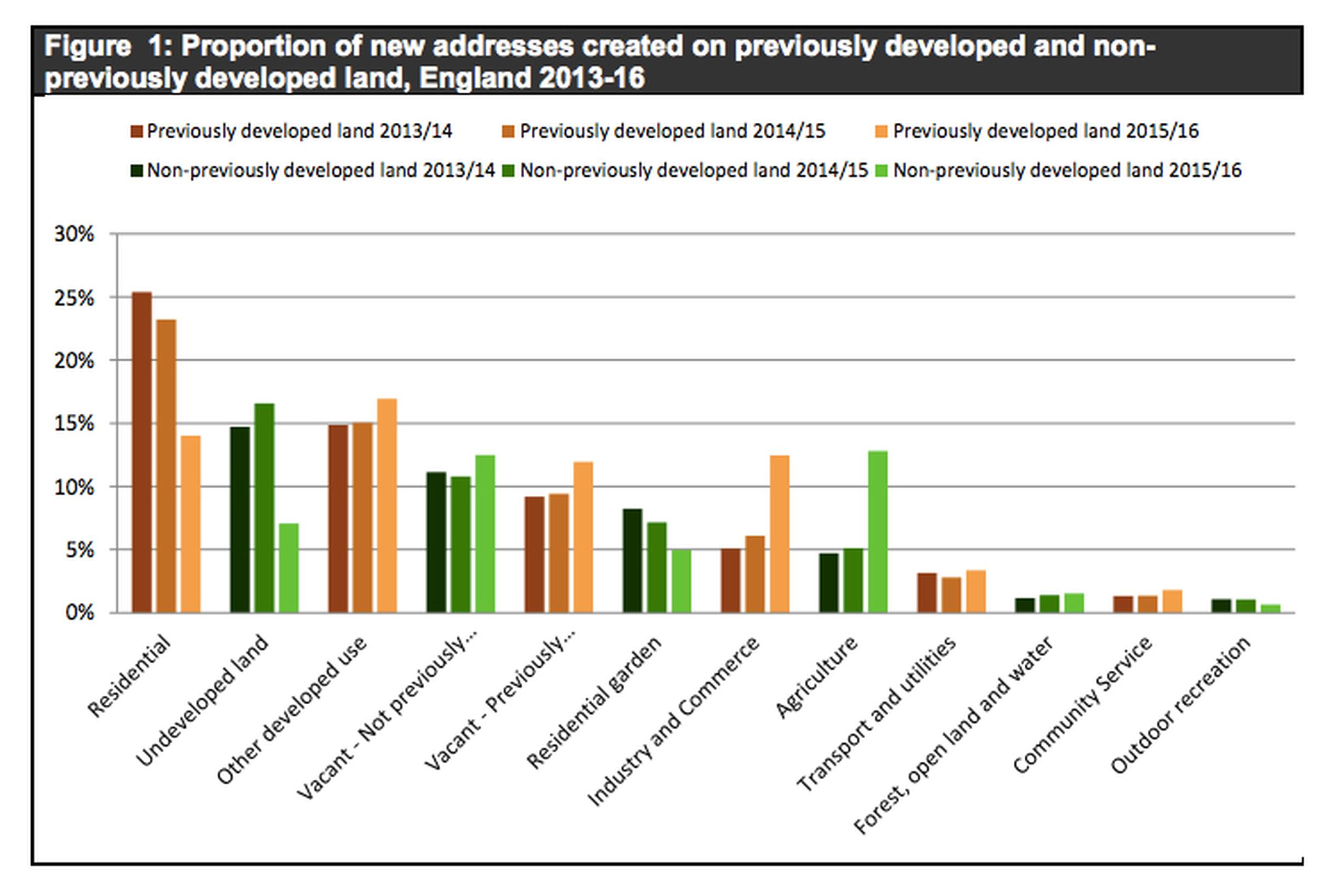
The third publication of land use change statistics has been published, using a methodology based on changes in Ordnance Survey products rather than from the physical observations that informed the previous series. It provides estimates for 2015 to 2016 on the creation and deletion of residential addresses and changes in density.
England has a land area of just over 13 million hectares. Of this area only about 11% is developed. Around 13% of England is Green Belt, encircling 14 urban areas and...
+83% moreTransportXtra is part of Landor LINKS
![]()
© 2026 TransportXtra | Landor LINKS Ltd | All Rights Reserved
Subscriptions, Magazines & Online Access Enquires
[Frequently Asked Questions]
Email: subs.ltt@landor.co.uk | Tel: +44 (0) 20 7091 7959
Shop & Accounts Enquires
Email: accounts@landor.co.uk | Tel: +44 (0) 20 7091 7855
Advertising Sales & Recruitment Enquires
Email: daniel@landor.co.uk | Tel: +44 (0) 20 7091 7861
Events & Conference Enquires
Email: conferences@landor.co.uk | Tel: +44 (0) 20 7091 7865
Press Releases & Editorial Enquires
Email: info@transportxtra.com | Tel: +44 (0) 20 7091 7875
Privacy Policy | Terms and Conditions | Advertise
Web design london by Brainiac Media 2020