The Met Office has launched a new portal to give organisations improved access to climate data and other resources, allowing them to better understand and respond to climate change.
Part of the Met Office’s wider strategy to maximise the benefits of its data, the Climate Data Portal contains 60 different data layers, as well as guidance and information.
Built using geospatial technology from Esri UK, the portal will make it easier for transport businesses and government organisations to combine open climate data with their own data and reveal the future impact of extreme conditions on their operations, including heatwaves, floods or droughts.
The main users are expected to be within government, transport, construction, land use, urban planning and energy industries.
The Met Office is the UK’s National Meteorological Service, providing weather, climate and environmental forecasts and severe weather warnings for the protection of life and property. The Met Office Hadley Centre for Climate Science and Services provides guidance on the science of climate change and is the primary focus in the UK for climate science. Its work is, in part, funded by DSIT (Department for Science Innovation and Technology) and supports the work of DESNZ (Department for Energy Security and Net Zero) and other UK Government departments.
The Climate Data Portal project is part of the strategic partnership between the Met Office and Esri UK, who have been working together for over 20 years. Combining Met Office expertise and data with Esri’s geospatial tools, the portal presents complex scientific climate projections in easy-to-use formats, ready to visualise and analyse in GIS and non-spatial applications or integrate into business processes for improved decision making. Spatial analysis can be performed at a global, regional or local level enabling location-specific action plans to be developed.
“Historically, climate science has defined the problem, now it’s moving to help with the solution, providing information at a local level which is highly relevant to UK organisations,” explained Professor Jason Lowe, head of climate services at the Met Office.
“By combining the Met Office’s latest projections with Esri UK's geospatial tools, the reach and value of this data is greatly extended. UK stakeholders can investigate their physical climate risks over the next 50 to 100 years. The most detailed climate projections reveal a greater chance of warmer, wetter winters and hotter, drier summers and these help users plan and prepare for extreme weather, climate change and the reporting which new regulations, linked to climate change, will require.”
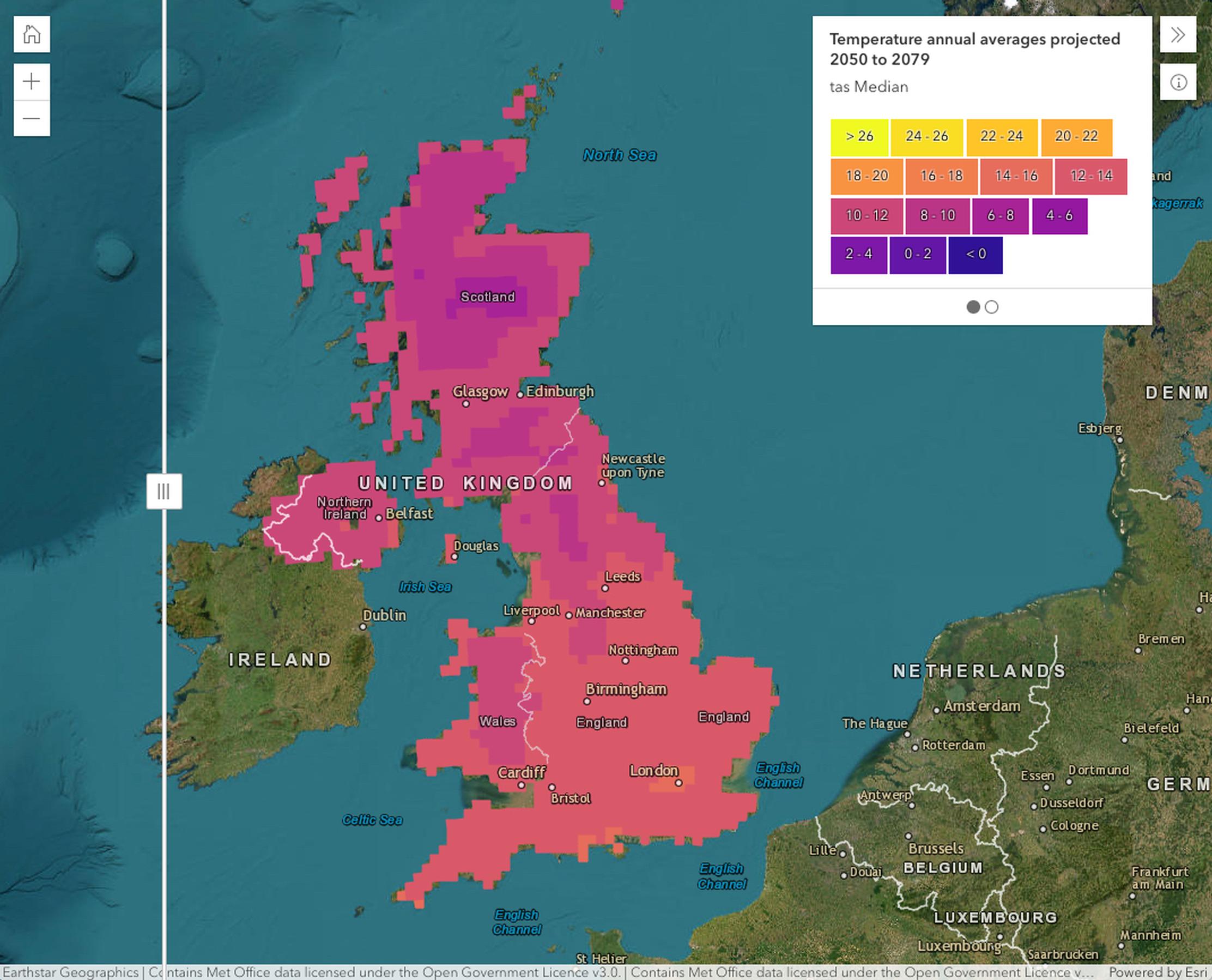
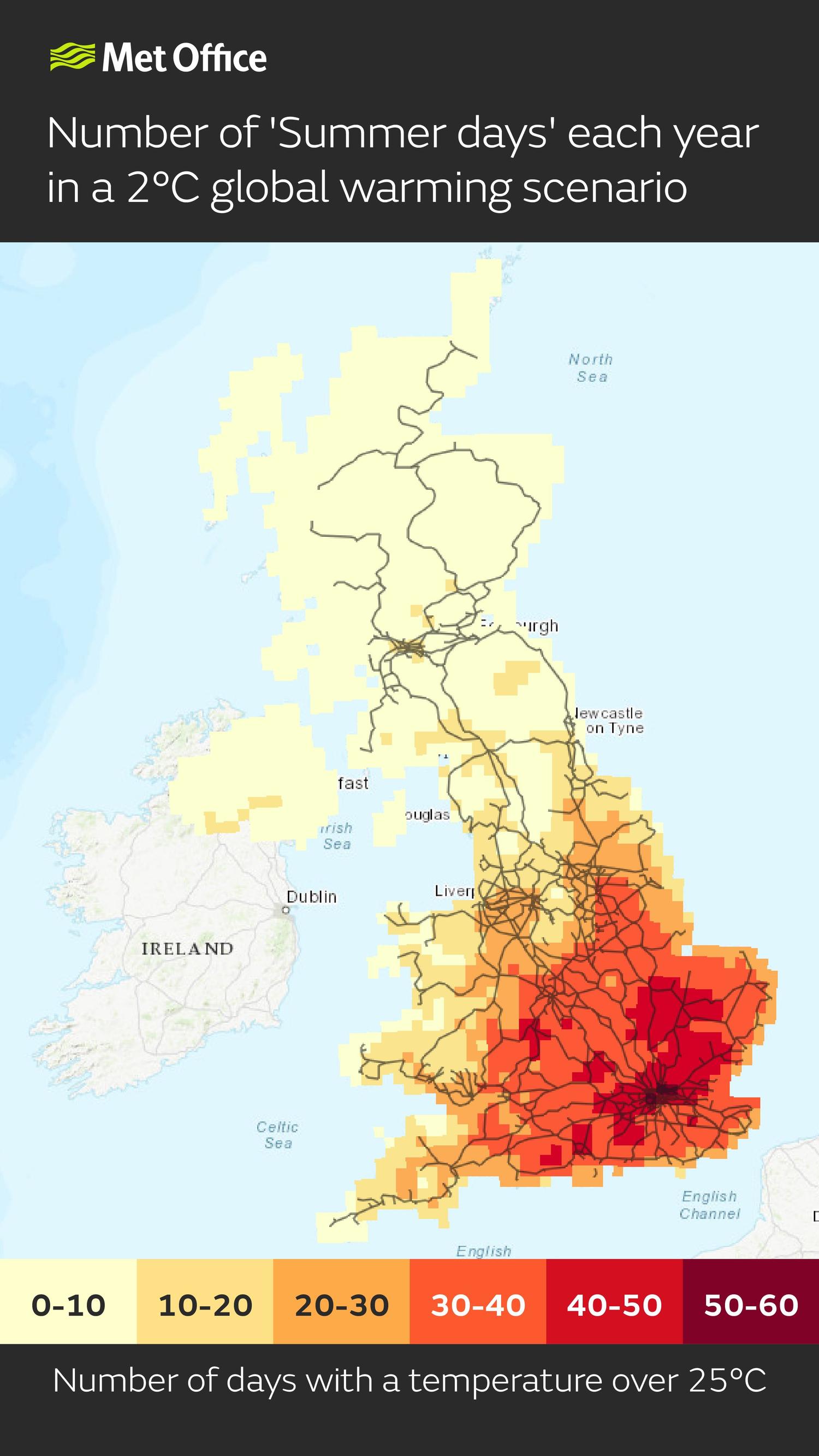
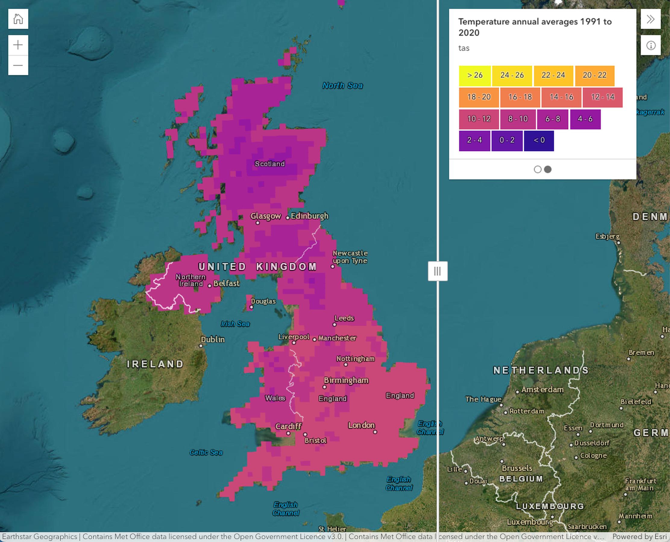
Data on temperature extremes can be used to understand the impacts on transport infrastructure, health and energy demand. For example:
The portal will also help provide insight to help organisations start their response to regulatory climate reporting such as TCFD (Task Force on Climate-related Financial Disclosures), which is being rolled out across the UK.
Esri develops geographic information system (GIS) software, location intelligence and mapping across 73 countries. Esri UK has over 450 employees with offices in Aylesbury, Cambridge, Edinburgh and Belfast. Customers include the Met Office, Environment Agency, Vodafone, Balfour Beatty and the National Trust.
“The Climate Data Portal is a giant step forward in making climate data more usable for UK stakeholders,” commented Pete Wilkinson, managing director of Esri UK. “Climate change presents a major challenge and this challenge is a geographic one. Using geospatial technology as a delivery mechanism for climate data makes it quickly accessible and usable in spatial and temporal analysis, helping to identify at-risk areas and develop location-specific action plans.”
TransportXtra is part of Landor LINKS
![]()
© 2025 TransportXtra | Landor LINKS Ltd | All Rights Reserved
Subscriptions, Magazines & Online Access Enquires
[Frequently Asked Questions]
Email: subs.ltt@landor.co.uk | Tel: +44 (0) 20 7091 7959
Shop & Accounts Enquires
Email: accounts@landor.co.uk | Tel: +44 (0) 20 7091 7855
Advertising Sales & Recruitment Enquires
Email: daniel@landor.co.uk | Tel: +44 (0) 20 7091 7861
Events & Conference Enquires
Email: conferences@landor.co.uk | Tel: +44 (0) 20 7091 7865
Press Releases & Editorial Enquires
Email: info@transportxtra.com | Tel: +44 (0) 20 7091 7875
Privacy Policy | Terms and Conditions | Advertise
Web design london by Brainiac Media 2020