Two thirds of pavements in London are not wide enough for people to observe the government’s advice to stay two metres apart, according to research by the Bartlett analysis
A new research group called _Streets, which involves Bartlett researchers, has analysed every street in Greater London and found that only 36% of pavements were at least three metres wide, the minimum requirement for members of the public to follow social distancing rules.
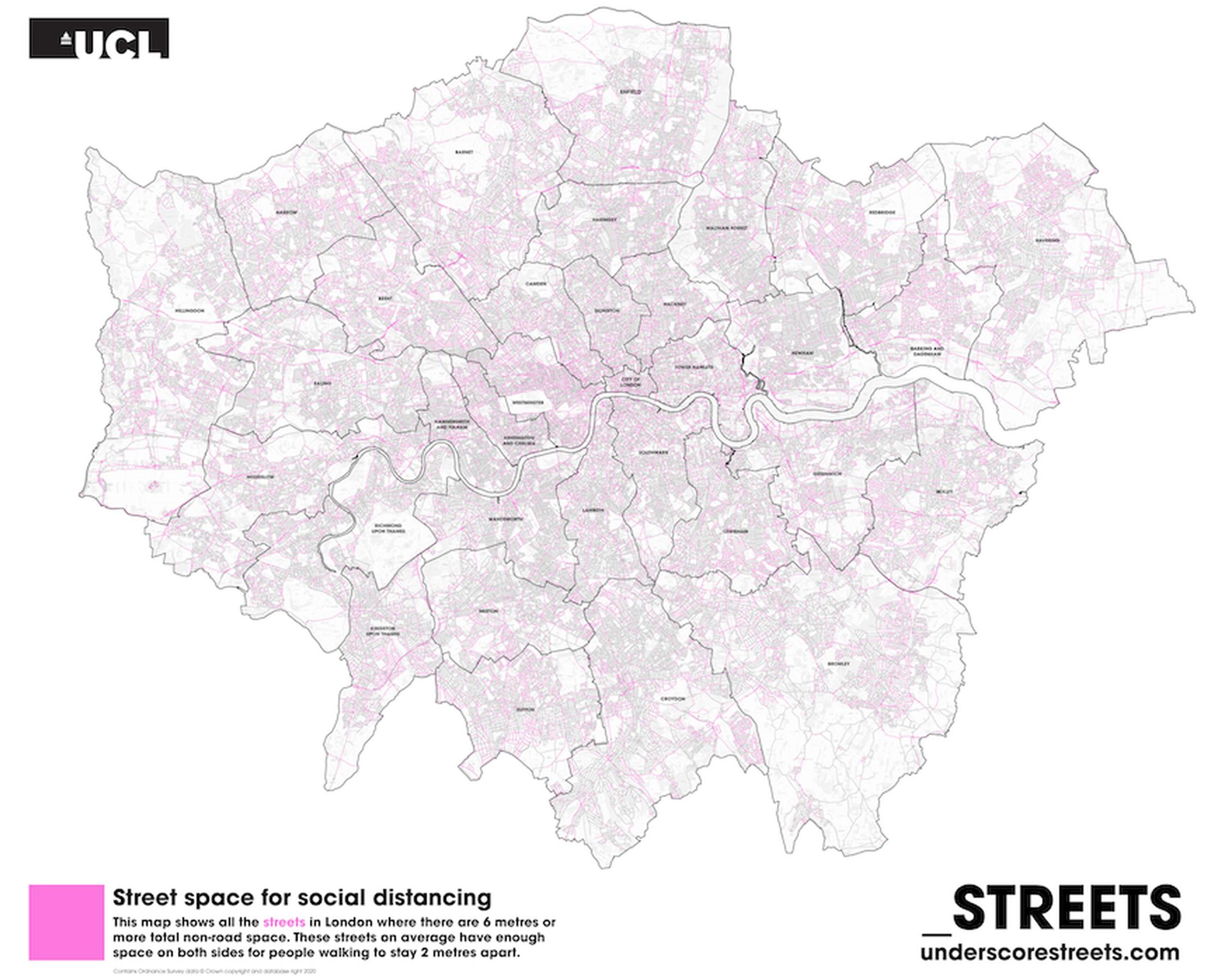
Of all London boroughs, the City of London has the highest percentage (51%) of streets that meet the minimum requirement of non-road space, while Hammersmith and Fulham, Wandsworth, Richmond upon Thames and Newham and Haringey all have the lowest percentages (between 26-28%).
Dr Ashley Dhanani, _Streets researcher and Research Associate at The Bartlett School of Architecture’s Space Syntax Laboratory, said: “While some may opt to walk in the road, this is not possible for people with pushchairs or with mobility impairments. Our research shows that there is an urgent need to reallocate street space in London so everyone can use streets safely.”
Nicolas Palominos, _Streets researcher and PhD candidate at The Bartlett Centre for Advanced Spatial Analysis, said: “Using new geo-computational techniques, we can study in detail the critical design parameters for the reorganisation of street space and inform planning decisions like pavement-widening, car-free zones and cycleways, which will effectively address the demands of social distancing.”
Using the findings, _Streets have created a map that shows all the streets in London that total six metres across or more of non-road space.
The _Streets research project received funding from the Engineering and Physical Sciences Research Council (EPSRC) and The Bartlett Innovation Fund and was a collaboration between UCL researchers, Healthy Streets and Tranquil City. Researchers used data from the Ordnance Survey, collected in a working paper analysing street spaces in Greater London.
UCL’s Bartlett School of Architecture’s Space Syntax Laboratory is an interdisciplinary research and teaching unit established in the 1970s. Space Syntax research studies the effects of spatial design on aspects of social, organisational and economic performance of buildings and urban areas and has led to a fundamental understanding of the relationship between spatial design and the use of space as well as longer term social outcomes.
The Centre for Advanced Spatial Analysis (CASA) is an interdisciplinary research institute within The Bartlett Faculty of the Built Environment, which explores the science of cities. The centre seeks to examine and offer solutions to the problems of resource efficiency and effective planning and governance shared by all cities.
TransportXtra is part of Landor LINKS
![]()
© 2026 TransportXtra | Landor LINKS Ltd | All Rights Reserved
Subscriptions, Magazines & Online Access Enquires
[Frequently Asked Questions]
Email: subs.ltt@landor.co.uk | Tel: +44 (0) 20 7091 7959
Shop & Accounts Enquires
Email: accounts@landor.co.uk | Tel: +44 (0) 20 7091 7855
Advertising Sales & Recruitment Enquires
Email: daniel@landor.co.uk | Tel: +44 (0) 20 7091 7861
Events & Conference Enquires
Email: conferences@landor.co.uk | Tel: +44 (0) 20 7091 7865
Press Releases & Editorial Enquires
Email: info@transportxtra.com | Tel: +44 (0) 20 7091 7875
Privacy Policy | Terms and Conditions | Advertise
Web design london by Brainiac Media 2020