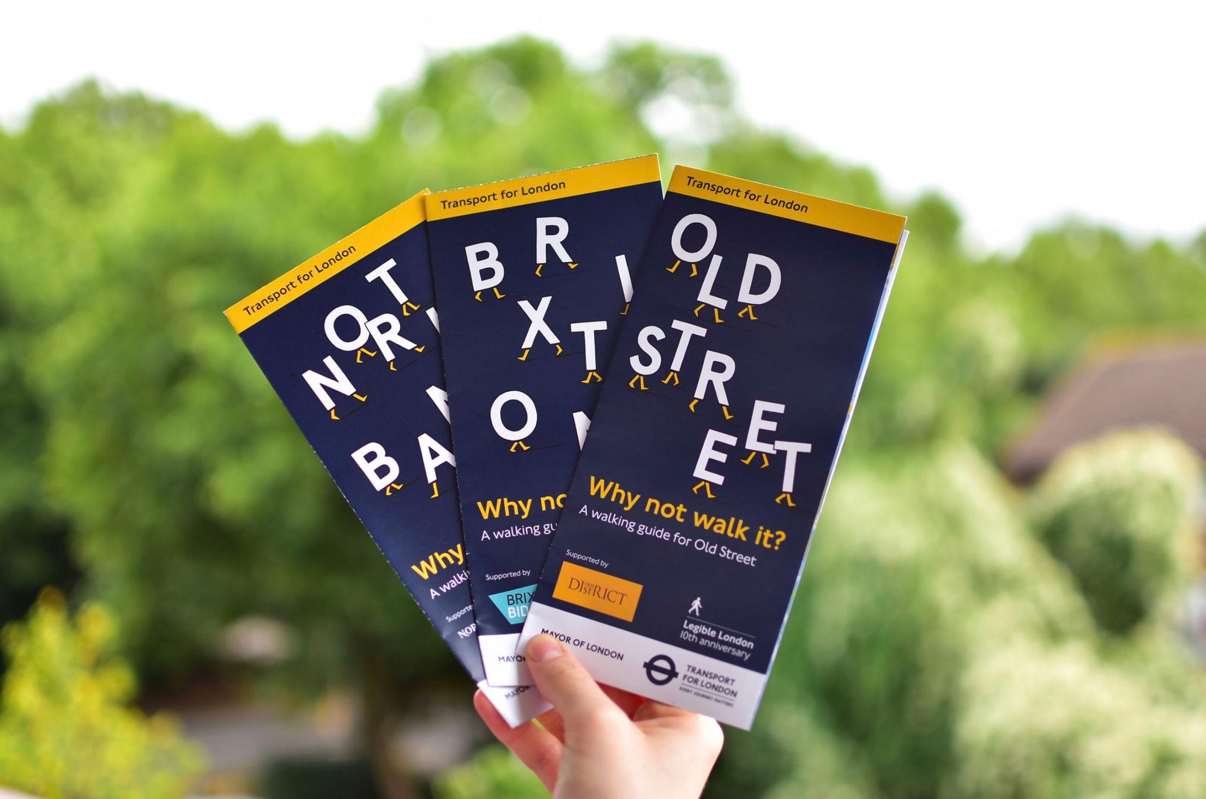
‘Legible London’ maps of Brixton, Old Street and North Bank have been published by Transport for London (TfL) to help people living, working and visiting the capital to make journeys on foot.
The maps are designed in the same style as the Legible London wayfinding signs dotted around the city, which have been produced by (TfL) in partnership with illustrator Matt Blease, and business partnerships in Brixton, Old Street and North Bank. There are now over 1,700 Legible London signs across the capital and, in line with the draft Mayor’s Transport Strategy, TfL is working with boroughs, businesses and other partners to install new signs.
A Public Health England report released last month said that 41% of the 15.3m English adults aged 40 to 60 walk less than 10 minutes continuously each month at a brisk pace of at least 3mph. Meanwhile, GLA analysis revealed that if every Londoner walked or cycled for 20 minutes a day, it would save the NHS £1.7bn in treatment costs over the next 25 years.
Mayor Sadiq Kahn’s draft Transport Strategy includes the aim of increasing the proportion of people walking, cycling and taking public transport to 80% of journeys by 2041, compared with 64% now.
The maps include fun facts about walking and the local areas and include a scale to work out distances that can be walked in five minutes.
Will Norman, walking and cycling commissioner, said: “Legible London helps people find out for themselves how easy and fun it can be getting around and exploring London on foot. And by helping Londoners find their way around, encourages more people to make walking a part of their everyday lives.”
Matt Blease, illustrator, said: “I've been really concerned about air quality in London for a while. When I found out about the project I jumped at the opportunity to get involved. Walking is the ultimate way to explore London and helps us all breathe a little easier.”
Earler this year TfL launched new versions of the Walking Tube map covering zones 1 to 3 and including National Rail stations. The maps show distances between stations and times on the same line. For more information about walking in London and to download the Walking Tube map visit www.tfl.gov.uk/walking
TransportXtra is part of Landor LINKS
![]()
© 2026 TransportXtra | Landor LINKS Ltd | All Rights Reserved
Subscriptions, Magazines & Online Access Enquires
[Frequently Asked Questions]
Email: subs.ltt@landor.co.uk | Tel: +44 (0) 20 7091 7959
Shop & Accounts Enquires
Email: accounts@landor.co.uk | Tel: +44 (0) 20 7091 7855
Advertising Sales & Recruitment Enquires
Email: daniel@landor.co.uk | Tel: +44 (0) 20 7091 7861
Events & Conference Enquires
Email: conferences@landor.co.uk | Tel: +44 (0) 20 7091 7865
Press Releases & Editorial Enquires
Email: info@transportxtra.com | Tel: +44 (0) 20 7091 7875
Privacy Policy | Terms and Conditions | Advertise
Web design london by Brainiac Media 2020