The transport development planning profession has heard the call for vision-led planning, and it’s running toward it with enthusiasm. At this year’s Transport Development Planning Conference, the energy in the room was unmistakable.
Practitioners want to design places around people, not traffic flow; they want to challenge “motor normality”; they want to escape a system that rewards predict-and-provide highway expansion and penalises sustainable alternatives.
With a target of 1.5 million new homes by 2029, and a revised National Planning Policy Framework (NPPF) that puts transport at the heart of plan-making, the stakes for how we plan, assess, and deliver sustainable development have never been higher.
The updated NPPF sets a bold ambition: "Transport issues should be considered from the earliest stages of plan-making and development proposals, using a vision-led approach to identify transport solutions that deliver well-designed, sustainable and popular places.”
Despite progress, many local authorities are still relying on outdated plans and traditional modelling approaches. The result? Sites that fail to enable active travel, over dependence on car-based access, and lost opportunities for creating healthier, more connected communities.
One session at the Transport Development Planning event showcased a series of tools deisgned to help users find sustainable locations - and this included the DfT Connectivity Tool. The session demonstrate the most useful approaches, tools and services available to help local authorities and consultants towards sustainable site selection, and ensure that visions are delivered through actionable, measurable outcomes.
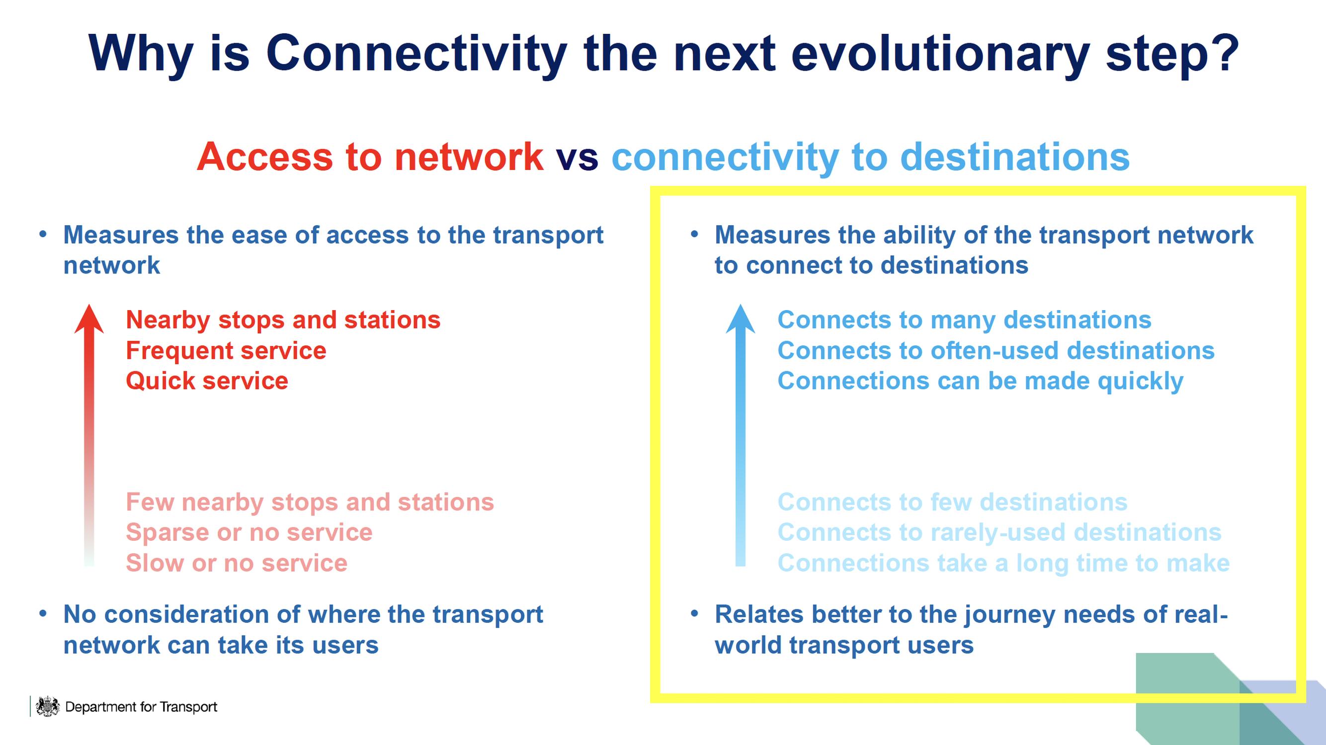
The Connectivity Tool scores places in England and Wales on how well connected they are to health services, education, shopping, leisure and workplaces. A trial version of the tool was launched last June and, as of this week, the full Connectivity Tool is now available to built environment professionals, setting a national metric of connectivity.
Planners and built environment professionals can now access the complete tool, and a second ‘lite’ version has gone live to the public. It is already being used to inform major growth projects, including supporting the work on new towns.
Historically, it has been difficult measure what a sustainable location is in transport terms. The tool addresses this by providing an evidence-based standard to ensure, for example, new homes, jobs and services are located where they can be accessed by sustainable modes of transport and to help to reconnect underserved communities.
It offers:
a new clear way of measuring what is a ‘sustainable location’ for development around transport projects
the full Connectivity Tool is now available to built environment professionals, setting a national metric of connectivity
a new Connectivity Tool Lite version will be released for the public, we’re opening up access online to everyone, free of charge
The web-based tool will help built environment professionals and planners in England and Wales give schemes a ‘connectivity score’ and better map them to essential services, helping to place them in areas that are better connected and easily accessible by walking, cycling and public transport.
Try the Connectivity Tool or the new Connectivity Tool Lite.
Sustainable development is a core aim of the UK’s planning system, but progress has been hindered by the lack of a clear way of measuring what a sustainable location in transport terms is. The Connectivity Tool tackles this problem by combining transport and land-use data in an innovative way to generate the first nationally agreed connectivity score for every location.
By establishing a clear, evidence?based standard, the tool will:
help ensure new homes, jobs and services are located where they can be accessed by sustainable modes of transport
support local authorities, developers and planners in making better decisions about where development should happen and plan for the infrastructure needed to support it
help to reconnect underserved communities, offering improved access to opportunities
strengthen the government’s wider mission of economic growth, ensuring transport investment unlocks opportunities across England and Wales
Lilian Greenwood, Minister for Local Transport, said: "Transport is central to unlocking growth. The Connectivity Tool gives planners and professionals the evidence they need to make better decisions about where development should happen, ensuring communities are well connected to jobs and services.
"By making the tool widely available, we are setting a new national standard for measuring connectivity and supporting sustainable growth across England and Wales.
"The Connectivity Tool is already being used to inform major growth projects. It is currently supporting the work on new towns, helping to understand the opportunities to make new towns accessible, well-connected and sustainable, in line with the New Towns Taskforce’s recommended placemaking principles."
TransportXtra is part of Landor LINKS
![]()
© 2026 TransportXtra | Landor LINKS Ltd | All Rights Reserved
Subscriptions, Magazines & Online Access Enquires
[Frequently Asked Questions]
Email: subs.ltt@landor.co.uk | Tel: +44 (0) 20 7091 7959
Shop & Accounts Enquires
Email: accounts@landor.co.uk | Tel: +44 (0) 20 7091 7855
Advertising Sales & Recruitment Enquires
Email: daniel@landor.co.uk | Tel: +44 (0) 20 7091 7861
Events & Conference Enquires
Email: conferences@landor.co.uk | Tel: +44 (0) 20 7091 7865
Press Releases & Editorial Enquires
Email: info@transportxtra.com | Tel: +44 (0) 20 7091 7875
Privacy Policy | Terms and Conditions | Advertise
Web design london by Brainiac Media 2020